Thursday, 21 February 2013

The Crummackdale Stadium Tour (Part 2)


From Thieves Moss, it can be quite tricky to locate the famous 'Beggar's Stile' - but this is the gateway to Moughton Scars - where things get even more spectacular.


Beyond the stile is the view down the dale, with our starting point over to the right.


There's now a thrilling traverse across the head of the stadium as can be seen in this picture. There is no path - just keep to the top of the cliffs.  It's a wonderful area where the glaciers have swept so much limestone clean.


Can you think of a better place to have a brew?  And a flask here is much cheaper than a coffee at Wembley.


There's a stunning view back along the crest of the scars towards Ingleborough.  Here his top is hidden in cloud, with the less shy Simon Fell to the right.  


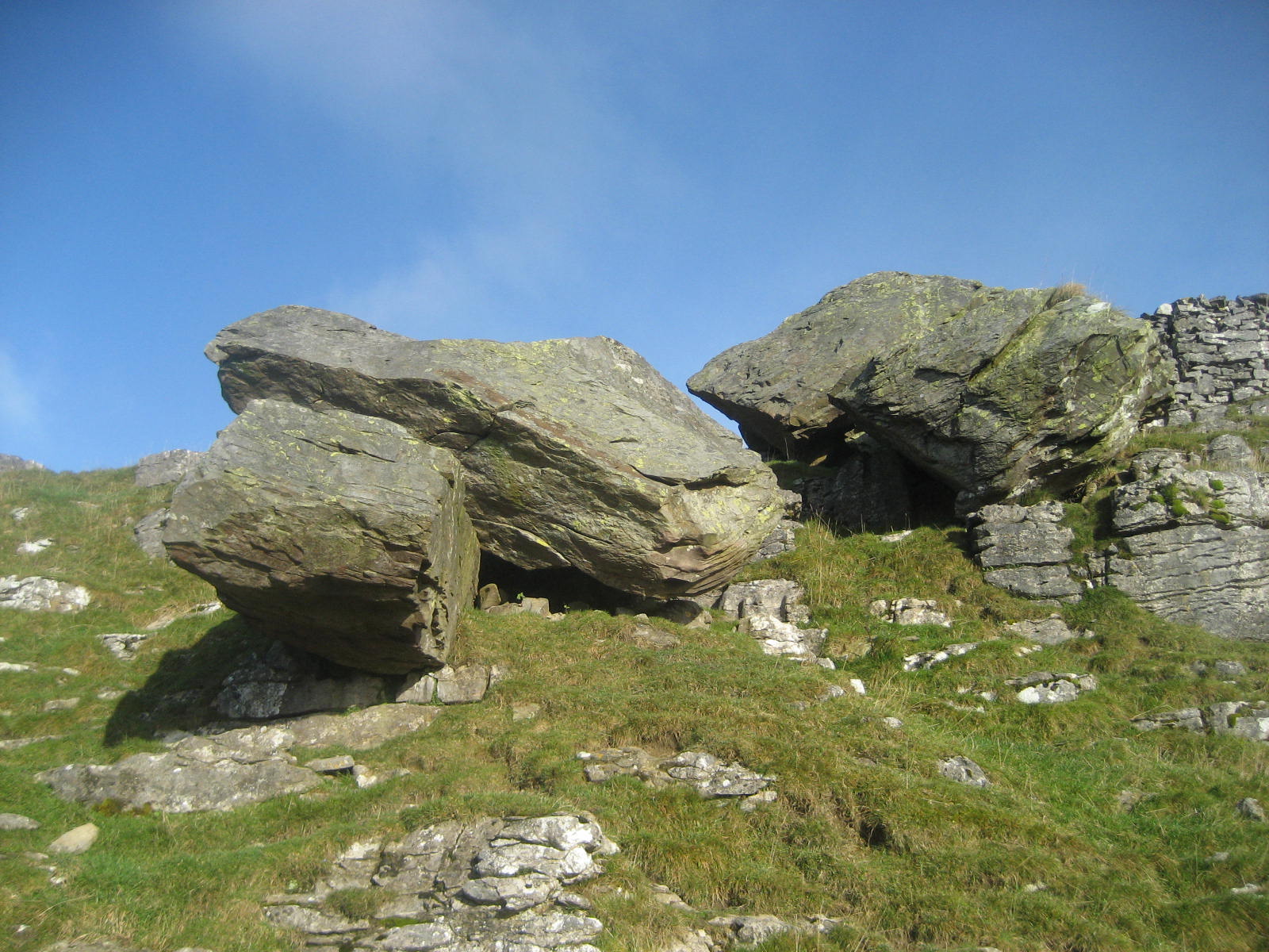
Shock horror!  Human beings - my first of the walk so far.  They were turning down towards the Moughton Whetstone Hole - where a peculiar banded rock is found, once used for sharpening Sheffield blades.  I've just passed the cairn you can see on the right and I'm about to head up to Moughton itself.


In doing so - I pass one of the few remaining natural Juniper forests left in the country.  These are used for making gin: I could have done with a gin and tonic at this point.  Hard to get the scale here, but each 'tree' is up to my knee in height.  Lovely.


At last, after wandering in a wilderness of Juniper and limestone, I reached the summit cairn. Just over 1400 feet in height, Moughton (pronounced 'moot'n') can feel like a Himalayan giant - such is the wild loneliness.  It is a dangerous place in mist as there are no walls and sheer cliffs nearby.  Stick to a fine day even if you have to wait a few years.  I was lucky with this one.


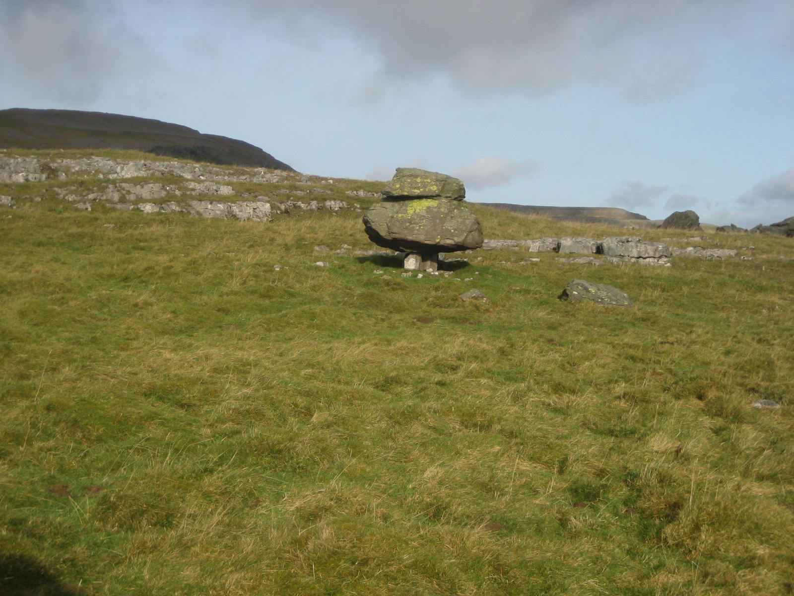
How great does Penyghent - the 'Lion of Ribblesdale' look from the summit cairn?  And by the way, look at my pet limestone dog peering down at my rucksack.  Isn't he gorgeous?  Pity all my butties had long gone.


Heading off Moughton in a south westerly direction (never easy) - this massive natural amphitheatre is reached.  Wander out to the bracken in the centre and it's almost overwhelming in scale.  I call it 'The Stadium of Echoes'.  First time my kids tried it, there was a resounding, 'Are we nearly back yet - back yet - back yet - back yet - back yet - back yet.  Have a go yourself, but don't get the farmer after you by trying naughty words ....


I've never tried them ..... honest ..

Continue south west from the Stadium of Echoes and a breach in the cliffs reveals this amazing abandoned waterfall - carved by the melting glaciers during the last ice age.  It seems impossible to tackle, but you go down the scree on the right as you approach - that is, the left side of this photograph.  


All that remains now is to pick up the path alongside white rocks, shown here, and head for the hamlet of Wharfe - where it's a simple last mile back to Austwick.  And don't forget the Game Cock Inn for a pint of Wainwright.  The old dear will be proud of you after this one.


A View of the entire 'stadium' from the air (aligned to the left of the image) Try to ignore Horton quarry which is not even imagined on the adventure. Austwick is the village at bottom left.  The info symbols above it are Robin Proctor's Scar and the Norber Boulders.  Thieves Moss and Moughton Scars are top centre with the dark patches of the Moughton Juniper forests clearly visible.  The info point below and to the left of the quarry is Moughton summit - and the Stadium of Echoes can be easily seen to the left of this.
Try the walk with the OL2 Ordnance Survey map: I'll be interested to know how you went on.

Stephen x

Wednesday, 20 February 2013

Sunday on Inglebrrrrrrrrrr!


It was a cold one on Sunday 17th February.  I always feel the route from Chapel-le-Dale, especially in winter, gives the mountain a real Alpine feel.  Not quite Chris Bonnington stuff, but we did have to cut steps in the ice above Humphrey Bottom.  We met a couple from Sheffield with their nine year old daughter and they were going up the mountain for the first time.  Being the limestone fanatics that we are, we made the journey into a round trip for them, coming back across Raven Scars.  I'll say something about Raven Scars while I'm here.  They offer some of the finest mountain views in the UK yet you never see a soul.


No sign of anything Icelandic at this point - but the Southerscales nature reserve is worth a day out with the camera in itself.  Just look how literally 'groovy' the place is.  


The Great Scar Limestone bench on which Ingleborough stands is about 800 feet thick.  All the water running off the Yoredale slopes of the mountain (a sandwich layer of limestones, sandstones and shales with a cap of grit) makes its way through this main limestone layer and resurges once it meets the impermeable basement rocks beneath.  


Such a hollow landscape causes dramatic funneling slumps, such as here at Braithwaite Wife Hole, reputedly the largest doline in Britain.  If you slither down inside it, the echo is out of this world.  Braithwaite presumably threatened to throw his wife down here once upon a time.  What had the poor lass done wrong, you do wonder? Cavers are often trying to link the hole through to nearby caves such as Sunset Hole.  This remarkable place is a little overwhelming and stops even the the most casual Three Peaks Walker for a good stare.  If you have a good camera, the view out from the bottom is amazing indeed.  


On this picture you can see the shadows of me, Joseph, Lucy and our walking companions on the brink of the hole.  No picture can really give it a sense of scale - but the shadows help. I think I'm the big lump at the far end.


The climb up from Humphrey Bottom - the rough land at the top of the picture, is steep enough at the best of times - but you can see the steps we had to cut with our ice axes - whoops - with the toes of our hiking boots.  This is my daughter Lucy - famous for climbing Ingleborough at four with her wellies on the wrong feet.


No she's not pulling up a sledge (top picture) - I think that's a rock!!!  My son Joe is at top left (and above) shouting instructions to our friends in the middle.  Who does he think he is - Sherpa Tenzing?


What a lucky girl.  When I've copped it and lie in Weathercote Cave - she'll have a third of my photos and rock specimens ...... no wonder she's smiling.  That's Twistleton Scars behind, by the way.  I'll be heading there next month.

I didn't take a picture of us on the summit because it was


Bloody Freezing!


The Wind Shelter provided just that: wind -  as there are a few holes in it here and there and little jets of freezing air blew down the top of your trousers and your back and everywhere else and it was awful.  Either that, or I'm knocking on a bit.


As soon as we headed off the summit, however, it was like stepping in a hot bath.  For those unfamiliar with the route, we have headed south from the summit cairn (the cold windy bottom bit) and are making our way down onto the route from Ingleton (from Storrs Common via Crina Bottom).  This is a good way down and well cairned but has to be the most  unexciting route up the mountain.  


We have scrambled around the shoulder of the mountain (top right) and admired the famous landslip - clearly visible here - and now we are on Tatham Wife Moss.  Our route now lies to the left and is pure joy with views to die for.  Up at top left you can see the gritstone cap of the mountain and below it, the forbidding-sounding Black Shiver ridge.  


The last thousand feet of the mountain, seen here, is composed of alternating bands of shale, limestone and sandstone formed by fluctuating sea levels between the ice ages.  Deeper water, of course, allowed limestones to form, where shallow water was fed by rivers that washed in sands and gravels, forming the other rocks.  The beds are known as Yoredales, from an old name for Wensleydale, where they are very prominent. The main limestone - or Great Scar limestone, forms the lower half of the picture but is covered here by a layer of glacial drift (known as till or boulder clay).  We have to walk a touch further to see it revealed - and how!!!


This picture is not only beautiful, but a textbook bit of geology is on show.  The gritstone cap, the landslip (at right), the Yoredale beds making up the sheer face, the layer of drift, and now - at last, the Great Scar limestone for which the area is world famous.  No other mountain in the UK can equal its fascination.


The next port of call is the Raven Scars cairn.  Wainwright calls it 'the cairn of a professional.' It sets off a picture of Ingleborough to perfection.


Finally as you do get to the end of the plateau beyond Raven Scars, the mountain is less of a cone and once again takes on that famous stepped profile.  The series of cliffs running just left of centre are known as the arks of Ingleborough.  

The Crummackdale Stadium Tour


East of Ingleborough is this magnificent English landscape, where the Crummackdale Glacier has, during the last ice age, scraped the topography down to the basement rocks and left some nationally famous feaures best remembered from O Level Geography!  I walked this stadium tour on remembrance day 2012 - a fitting silence if ever there was one.


These two guys were the first to greet me as I closed my car door in Austwick.  When you take a look round Austwick, you'll want to live there.


The first wonderful sight as we head up the west side of the stadium is Robin Proctor's Scar.  Robin lived in Austwick a long time ago and was rather over indulgent with the beer.  Fortunately he had a super intelligent horse who transported him home daily in drunken state and dropped him onto straw bales in the barn to sleep off his hangover.  One day, more drunk than ever, he picked up the wrong horse in the pub stables - and being unaware of his new master's destination, the horse dropped him over the edge of this precipice. 


Nappa Scars are beloved of geologists.  The lower of the two photographs above shows clearly the very ancient Silurian rocks (near to the camera) with a thin layer of limestone conglomerate in between, acting like a cement.  On top of course, are the famous Great Scar Limestones.  Hundreds of millions of years separate each of these three layers.  A similar picture of the rocks can be seen at Thornton Force on the Waterfalls walk.


Things get mega exciting as we retrace our steps from Nappa Scars and head up to the famous Norber boulders.  Note the reddish brown colour of these erratics which should of course, lie below the limestone.  Instead, they're on top!  The glacier has plucked them from the valley sides before riding up over the brow of the hill and slowly dropping them as it melted some 12000 years ago.


Course, they just get better ...


And better ....


And even better ....


They also have breathtaking views .. but then cometh the piece-de-resistance ...


Is this the most famous single rock in Britain?  He looks proud enough.  This I call the Norber Mushroom.  Let's go an have a better look.


He was left here by the glacier and, over thousands of years, weather and erosion has reduced the limestone pavement beneath him to a series of grass covered bumps.  The rain couldn't get beneath him, of course, so he's been left on three very precarious looking pedestals.  How they bear his weight is beyond belief ...


From this angle he's taking a walk ...


'Hey stop staring at my legs!'


In the vicinity are the Norber Dominoes - or the Giant's Book.  Which do you prefer?  That's the summit of Norber itself, just behind.


Heading up to the ladder stile (you can just see it in the corner of the field) note how ingenious farmers of yesteryear incorporated the Norber boulders into their walls!


Ever doubted you were walking in a stadium?  Well, just leave the rocks alone for a minute and take a look at this.  That's Moughton Fell in the foreground, the route of our return, with Penyghent peeping up behind.  Not a person - not a sound.  It's eleven now - so a very fitting spot to pay our respects to those who saved all this for us ...


As we head along the pathless ridge to the head of the stadium, views open on the left to Clapdale (near to Trow Gill) - and on the right Penyghent plays a disappearing act with the clouds.  This is one of England's loneliest places.


We then arrive at the great amphitheatre of Thieves Moss.  Presumably the haunt of robbers who tackled packhorse travellers here a long time ago.  Their screams would have been to no avail.  Only the curlews would have heard them.


The sheer amount of limestone here is amazing indeed.


You also meet the strangest weathered limestone phallic symbols


Ok then - the half way stage.  We'll eat the butties looking down over Crummackdale (see the view below) and we still have the Juniper forest of Moughton, The Stadium of Echoes and the Abandoned Waterfall to go.  Enjoy your lunch and we'll have part two tomorrow.