Saturday, 1 November 2014

The Waterfalls of Ingleton

Rock Music for Connoisseurs

(part two)


The second half of the Ingleton Waterfalls trail is, for many, even more impressive than the first.  Following the valley of the Doe as it emerges from Chapel-le-Dale, the water has carved a fabulous succession of cascades through the ancient rocks exposed by the North Craven Fault.


This aerial view shows the narrow valley of the River Doe where the stream is hemmed in between walls of greywacke and slate.  Locals have been aware of the nature of this rock for centuries - though the quarry which exploits it is getting a little too big for comfort.  In fact, quarrying operations have caused rock piles to move inside Skirwith Cave - a show cave which opened in the 1960s (see my post from April 2013).  The cave has long been closed to the public, but can still be explored with care.  This picture also shows clearly the massive wedge of limestone trapped between the Craven Faults - forming Swilla Glen on the western branch (River Twiss) - and exposed at the old Meal Bank quarry just south of Cat Leap Falls.


Above the famous Thornton Force, visited in part one, the landscape is dominated by the massive terminal moraine barrier of the Raven Ray, seen in the photograph above as a huge 'hump' in the landscape.  Some 15, 000 years ago, when the glacier occupying Kingsdale began to melt, it dumped this great mass of debris across the valley - blocking the exit for the river escaping beneath the snout of the glacier, and eventually causing a narrow lake to form in the valley above.


The clay and rock fragments making up the moraine are clearly seen in this picture.


It's almost as if a giant dumper truck has let it all go in the not too distant past!


Here, the limestone benches of Kingsdale can be seen clearly.  As the glacier began to melt further, the water deepened and eventually overflowed over the lowest part of the Raven Ray barrier - with the river taking a new course: it's old one having been covered over and hidden by the moraine barrier (left on the picture above).  Eventually  the overflow cut down through the Raven Ray, as can be seen clearly here - and went on to form Thornton Force!


This aerial view makes things a bit more clear.  The old course of the River Twiss can be seen in blue, with the new course of the River flowing slightly to the east.  A massive rush of meltwater carved the little gorge above Thornton Force - so the waterfall we see today is a young feature in geological terms - no more than about 14,000 years old.


Here is the gorge above Thornton Force.  Already the Twiss is begining to escape into fissures in the limestone as they are widening over time.  Water escaping in this way eventually emerges out as a small cascade called Little Thornton Force, to the left of the main waterfall.


A view from a precarious position of the River Twiss - showing how its has eroded the lip of limestone below the Raven Ray to form a gorge before plunging over Thornton Force (off the picture to the right).


The powerful action of the meltwater can be seen in this photograph.  The water has cut through the Great Scar Limestone and is about to plunge over Thornton Force.  


A series of superb cascades precede the main waterfall.  Geologists have prediced that, as more and more water sinks through the limestone river bed, Thornton Force will eventually become a dry, abandoned waterfall rather like Malham Cove and Easegill.  


At the present time, though - the water plunges 46 feet over the Great Scar Limestone as it has done since it broke through the Raven Ray barrier all those thousands of years ago.  The fall is actually several yards further north than it would have been originally - and has been cut back over many centuries by erosion.  Eventually it will keep cutting back into the gorge, the water falling further and further to the left of the photograph.


The original waterfall was probably in the vicinity of the camera!  You can see clearly how it is cutting back and eventually will be inside a narrow gorge which will fully dry up as the limestone cracks in the river bed widen.  Only in flood will the waterfall then be active. Mind you - it will be thousands of years before that happens .....


It's difficult to leave one of the greatest geological wonders in Britain, but let's follow the track beneath Twistleton Scar End and head for the valley of the River Doe - and the 'return leg' of the waterfalls trail.


Ingleborough dominates the landscape now - resting on its plinth of Great Scar Limestone - with the superb glaciated valley of Chapel-le-Dale running from left to right across the photograph.  The glacier which formed the valley would have nearly reached the top of the mountain itself.  It has scoured away all the covering rocks to leave the pavements bare. This is classic limestone country by any standards.


Chapel-le-Dale from the waterfalls trail.  The full width of the glaciated valley can be seen, and the 500 feet thick Great Scar Limestone resting on the basement rocks along which the River Doe is flowing. 


We first enter the enchating valley of the Doe at Beezley Falls.  Here the River Doe wanders over the upturned basement rocks in a series of stunning waterfalls, easily matching those of the River Twiss.


The Beezley Triple Spout is one of the highlights of the walk.  Here the water rushes over a rib of greywacke into a deep plunge pool.


With the coming of the railway to Ingleton, the stunning potential of the falls as a tourist trap was recognised, and paths were cut into the rock allowing the public access to an otherwise inhospitable glen.  Notice the vertical ribs of the ancient rocks here.


Every twist and turn brings another delightful view.  These are the Lower Beezley Falls.


Downstream, we approach the cascades of the Rival Falls, competing for glory and status.


The Rival Falls are an enigma.  The two cascades are separated by a plunge pool believed to be 80 feet deep, and known locally as 'The Black Hole'. 


A lovely monochrome view of the Rival Falls.


The River Doe then pierces through a joint in the greywacke, forming the impressive Baxenghyll Gorge.


A small bridge allows the visitor a privileged peep into the depths of Baxenghyll Gorge - and it is one of the great sights of the Three Peaks: far better, in my view, than the Strid at Bolton Abbey.  Certainly more beautiful.  


Man has been quick to exploit the Ingletonian rocks along the valley of the Doe, as this old quarry testifies.


As the path climbs steeply upwards, we get the first tantalising glimspe of the beautiful Snow Falls, hanging like a brilliant white cornice over the dark rock.


The Snow Falls are shyly hidden from the main path, and need a zoom to see properly - but they are a stunning sight in any conditions.


Looking downstream below Snow Falls - where the river at last begins to calm down as it approaches the limestone below the North Craven Fault.


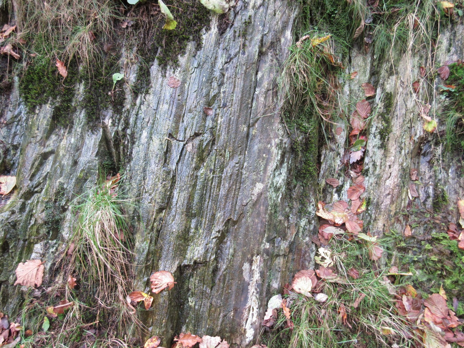
Vertical ribs of Ingletonian slate, brough to the surface by the North Craven Fault, and wrenched into the vertical position by earth movements that must have shook the area to the core - or at least caused one heck of a Tsunami!


The quarries show the vertical beds of these fascinating ancient rocks splendidly.


The path has been ingeniously engineered into the old quarry face.


As we cross the North Craven Fault we arrive back the same downthrown limestone that we met in Swilla Glen in part one of our adventure.  Here Skirwith Beck crossed the path ....


Before plunging down the ribbon-like cascades of the Cat Leap Falls.  These are missed by most visitors, and just need a short diversion down the steep hillside to the right of the path.


Looking back up th evalley of the River Doe.  The Great Scar Limestone plateau of Scales Moor can be seen at the top right.  The rest of that limestone has been eroded away to leave the lifted basement rocks exposed (covered by the trees and occupied by the waterfalls).  On the left is the next big 'slab' of limestone, downthrown by the North Craven Fault - and which once lay completely level with the skyline at top right.  The 'slippage' due to the fault can clearly be seen in this photograph.


The old Meal Bank limestone quarry is fascinating to look at.  Notice the general curve of the limestone, on the same anticline that we saw in Swilla Glen.  There are also very thin seams of coal in the limestone where sea conditions became boggy and swampy allowing vegetation to flourish for a time - way back in the Carboniferous Period.


The dip of the limestone beds in the quarry. Very thin coal and shale layers are present in the rock.


And finally - all drama disappears.  We cross the South Craven Fault back into Ingleton and the limestone is now hundreds of feet below - the Ingleton Coal Field lying to the south of the area.  The Ingleton Waterfalls walk has to be one of the geological wonders of Europe.  For sheer beauty, too - it is up there with the very best.    Go and enjoy every step.


Stephen x

Monday, 27 October 2014

The Waterfalls of Ingleton

Rock Music for Connoisseurs

(part one)


The great writers and travellers of the past were in no doubt: 'I know of no place in this kingdom where mountain, forest and water are more sublimely or effectively combined than in the two glens formed by the streams of the Twiss or Doe, and Greta,' wrote Harry Speight in 1892 - emphasising the confusing names given to the two creative bodies of water.  Thousands today will agree.  Despite the 'commercial' pull - the tea huts and the cafes - the 'pay on entry' status that niggles with some people - this is one of the very best adventures anywhere in the UK - don't let anyone fool you into thinking otherwise.  Here, not only is there beauty and savagery in equal measure - but the story of the Dales rocks is laid out for all to see.  


Let's just get some understanding of why things are so exciting before we begin.  All that Great Scar Limetone, overlaying the buckled beds of the basement rocks, used to lie in one continuous slab: effectively it would have continued in a south westerly direction across the photograph - but those two blue lines are the reason why not.  They are roughly the position of the Craven Faults, two gigantic fractures through the rock that began moving in Carboniferous times.  In the middle section (in pink) the limestone south of the fault line was 'downthrown' hundreds of feet from its original position to create, in effect, a huge 'step' in the landscape, ideal for a stream or glacier to play havoc with.  Got it so far?  Next look at the South Craven Fault which runs through Ingleton itself.  The limestone to the south of this was downthrown again - and now it lies hidden beneath the surface and is covered by a layer of coal.  Amazing to think then - that the hidden limestone buried underground at the bottom left of the photo once lay level with that you can see at the top right!!  Nothing more dramatic than geology ....


That's why we get this amazing adventure playground for the Doe and the Twiss.  Thanks to the unique landscape created by the Craven Faults - they have carved out a magnificent series of glens and waterfalls - and that's what we're going to explore today.  Hopefully - then, it will be more than just a walk - but an experience.  Notice, for example, how Swilla Glen has been carved through the 'downthrown' block of limestone that lies between the two faults?  Notice how Thornton Force and Pecca Falls have been carved into the 'uplifted' basement rocks above the North Craven Fault?  It all starts to make sense once you get your head around the faults and the rocks on show .... so let's go and see for ourselves ...


Once you've paid your entrance fee, you are, effectively, standing on a layer of alluvium (river debris) which overlies the Ingleton coalfield.  Where is the limestone?  Well - remember, it is buried beneath your feet and has slipped down along the South Craven Fault, which is passed unnoticed as we move along the bank of the Twiss from the car park.  Look at the gently flowing Twiss here and feel sorry for it.  Much of the water has not only tumbled down some of the most aggressive falls in England, but its also been through some of the most dramatic caves - way up on the limestones above the North Craven Fault in Kingsdale.  Let's go and follow its adventures!


 As soon as we cross the South Craven Fault we enter the dramatic and beautiful ravine of Swilla Glen.  Here. the massive block of limestone has been trapped between the two faults and is effectively a 'sitting duck' for a youthful river to play with.  The limestone can be seen on the right - whereas behind me it is hundreds of feet underground - let's not forget that. 


I've read reviews on Trip Advisor where the Ingleton Waterfalls are described as a 'rip off.'  Are you kidding?  If you'd rather spend your brass on a McDonald's Drive Thru then go ahead.  Look at Swilla Glen here - near a place once known to early travellers as 'Creeping Steads' as they had to struggle beneath low foliage to enter.  It's truly stunning - and you can see on the right how the limestone is clearly dipping along the limb of what we call an 'anticline'.  Basically, the basement rocks far below are folded like a massive piece of corrugated iron, and here the limestone is following the trend. It formed then, on a very undulating sea bed!


Looking across the Twiss in Swilla Glen.  On the right, the dipping beds of Great Scar Limestone can be seen well.  Ancient Yews add a beauty to the scene - as if it was needed ..


The Great Scar Limestone was formed some 340 million years ago: millions of shelly creature remains pressed together in a shallow tropical  sea when 'England' lay near the equator.


Here it can be seen in close up, following the general anticline of the rock strata.


A wonderful view of the dipping limestone.  In Swilla Glen the Twiss says goodbye to the limestone before emerging onto the gentler plains of the Ingleton coalfield south of the village.


Looking into the upper reaches of Swilla Glen, the limestone towers hundreds of feet high and the view is one the best in England.  The paths are carefully engineered to hug the left hand cliff, first being opened to the public in April 1895.  


Even the works of man have a delightful nature that does not seem out of place in this woodland setting.


Between wide walls of limestone, the Twiss is clothed in luxuriant vegetation. Many years ago the rare Lady's Slipper Orchid was found here.


The Great Scar Limestone in the upper reaches of Swilla Glen.


A bridge then spans the Twiss, taking us to the opposite bank as we approach the North Craven Fault.


The impressive view upstream from the bridge, the Twiss still working its way down through the massive slab of limestone lying between the two faults.


Things then get really interesting on the opposite bank.  The cave is a failed attempt to find a vein of lead, but look carefully and you will see two distinct rock types.  On the left, the 'downthrown' Great Scar Limestone through which Swilla Glen has been cut - and to the right of the obvious crack, a banding of Ordovician 'mudstone' or shale, much older than the limestone and which is here lying on a branch fault next to the main North Craven Fault itself, hidden in the trees to the right of the picture.  From now on, the basement rocks have been lifted to the surface - the limestone that once lay above them having been eroded away: perfect conditions for some really dramatic waterfalls to tumble down!


A close-up of the perfect example of faulting: Great Scar Limestone to the left, 340 million years old - Ordovician mudstone or shale to the right - 100 million years older!!! Get your head round that one!  The mudstone was laid down when a swamp began to form over the basement rocks beneath it - prior to the shallow sea conditions which eventually formed the limestone.  


Looking upstream beyond the North Craven Fault - the line of which can be traced in the trees on the left after a few minutes of careful scrambling.


As we emerge from the tree canopy for the first time - the limestone we see now is on the upper reaches of the slopes far above us on the left.  This is the limestone that was uplifted above the North Craven Fault and most of it has been stripped away by water and ice.  Only these upper flanks remain.  It is the famous basement rocks, or 'Ingletonian' series, that concern us from now on.  Rarely do we get a chance to see this ancient basement - formed before there was life on earth - but here we can't miss it!


Our first glimpse of these legendary Ingletonian rocks.  Debate has raged for decades about actually how old they are.  They consist of mudstones, sandstones, coarser sandstones known as 'greywackes' and siltstones - all of which are loosely termed 'slate' as it is believed that they were effectively cooked by a layer of molten granite deep beneath what is now the Dales some 500 million years ago.  Currently believed to be Ordovician - the lack of fossils has meant that some geologists reckon them to be even older - Precambrian - and that is really knocking on a bit.  What fascinates is their greenish cast - their amazing toughness - and the way in which they have been wrenched by earth movements into a crumpled, vertical position - and it's all so obvious as we take a peek!


In fact, these ancient rocks make up the very path we're walking on - and even the most casual walker must notice the immediate difference.  


The buckled, vertical ribs of these ancient rocks have been eroded to produce the magnificent Pecca Falls - first on the list of the Ingleton Waterfalls route as we walk it in a clockwise direction.  The more resistant greywacke bands form the steps, with the mudstones being worn away to form the plunge pools.  


To the left of the falls, the vertical beds of the Ingletonian rocks are startling to see - here in this old quarry.  Considering that these beds once lay in a horizontal position - you can see just how massive the earth movements were to cause this vertical buckling - to effectively stand these beds on their end!


Get up close with the Ingletonian!!   Trips off the tongue, now - doesn't it?


Mind you - you can be forgiven for ignoring an old quarry when you have the Pecca Falls on your doorstep - and they don't do things by halves in Ingleton.  These are just the lower falls ....


This little beauty is the middle one ...


And it looks stunning from just about any angle ...


And as for the upper falls - the Pecca Twins - well ... they're just gorgeous aren't they?


Equally so in black and white - which gives that 1895 'opening day' feel.


You can have a field day here with a camera - I just can't get away - yet you see some just rush past ... phone comes out for a second as they walk - quick 'click' and off ...


Above - and not to be outdone - lies the roar of Hollybush Spout.  I can never get a good picture of this one.  It's a little beggar for the camera - but just look at those beautiful, vertically bedded greywackes:  lovely!


Attempt number 3145 ...(ahem)


You're all getting excited now aren't you 'cos you think we're going to Thornton Force?  Well hold sweat, folks. We're not ...... yet :)  Let's just keep you waiting and be annoying!  Here's evidence for all to see that the Ordovician rocks have been vertically buckled and lifted to the surface - right by the path.  Oh, and by the way - I've just stopped for a brew at the tea hut - and believe me the brew on the waterfalls walk is AWESOME.  It steams down your throat as well as any force hits its plunge pool - and the home made fruit cake has geological layers of cherries, dates and nuts to rave about for hours .... !! Right, I'll shut up now ... let's go ..

By the way ... notice the band of limestone left at the top of the pic ?  All the rest has been eroded away ... 

Oh ... and a brew - if you're south of Watford Gap - is a cup of tea.  


There's even an island in the River Twiss formed by a resistant band of the vertically bedded Ingletonian rocks.  Is it still tripping off the tongue?  My kids used to love playing on this. It's known locally as Cuckoo Island - and would have been a great setting for an Arthur Ransome novel.


Another view of the island, from the path - just to be even more annoying.


Oooh - what's that peeping over the tree tops? And humans? Come on - he doesn't usally do humans on his blog posts???  Surely not!


This is the one they all come to see - (me included).  It's the one on all the postcards and the book covers - and I can't believe I've left it off my blog until now.  Perhaps it's because I don't like being conventional.  I like to go for the less obvious and not follow every Tom, Dick and Harry - (or pretend not to) but hey - I adore this place - and who couldn't?  Thornton Force lets its surroundings speak ... it needs no description.


The geology of the place is legendary even by European standards.  See the water there, plunging over a lip of Great Scar Limestone?  Well, the rest of that limestone has been eroded away (towards the camera) and the 'lip' actually sits on the 'buckled' basement layer of Ingletonian 'slates' - actually vertically bedded sandstones of Ordovician Age.  So when you're mad enough to clamber behind (as I always d0) you're able to walk on one rock - and touch the other.  You can let your hand span an imense period of geological time in just a second - and that is mesmerising stuff.


Once you set off behind, taking great care - the vertically placed 'slate' is obviously overshadowed by the huge lip of limestone - with a thin 'conglomerate' between - of pebbly fragments cemented together by muddy limestones - rather like the jam in a Victoria sandwich.


The pebbly conglomerate is sandwiched between the vertical 'slates' and the limestone above.  It once formed an ancient beach before tropical sea levels rose and the conditions became suitable for limestone beds to be laid down.  Incredible to think.  This resting of the horizontal bed on a vertical bed beneath is a famous example of a geological 'unconformity.' Certainly nothing seems to conform in Ingleton.  The author of this blog is a fine example but don't tell anybody.


The 'hand-span of time.'  Only 170 million years between my thumb and fingers.  !!!  Wonder how long we'd have to multiply a human life time to match that one??  Dwell on it - and wonder at the insignificance of your own existence.


The classic view back along the unconformity with the limestone above and 'slates' below - and the smaller fall of 'Little Thornton Force' showing itself well after a period of heavy rain.


Once you are behind the real thing - still keeping remarkably dry - all human achievement and design suddenly doesn't quite do it.


In fact, you can shut off the outside world completely.  


A great view of the the limestone - resting as it has for at least 340 million years on the ancient vertical beds below - a place to return to again and again.  You can't come to Thornton Force without going behind the waterfall ....  


And you can't come to Thornton Force without getting the butties out!!!  So ... you've survived the geology lesson ... you've braved the waterfall ...... join me next time for part two of our waterfall adventure.  We'll wander this time down the narrow valley of the Doe - where there are even more geological wonders and surprises.  Oh, and don't tell me you've never had a go at balancing on that rock ...... you know which one I mean ....   you want to now, don't you?


Stephen x