Whernside by the Waterfalls
The Wild Way to the Summit


An Affectionate Guide to the Highest and Most Neglected of the Three Peaks of Yorkshire

Why bother with 'Woeful Whernie?' they will ask you. The beached whale. The great useless lump. The 'boring' one. I've had this said so often. Yet I have a special fondness for this mountain which has come about from years of exploring its every nook and cranny - and, when I was stood at the fabulous waterfall of Force Gill today, a treadmill of exhausted walkers filed past; and not one - and I mean not one ... turned the 100 yards off the path to see a fall equal to, if not better than, the famous falls of Ingleton! Whernside deserves better than being one of the three in a long slog. As with the majority of British mountains, it can't live with Ingleborough for sheer interest, but it has features that neither of the other two have, and deserves to have them celebrated ...

Whernie's problem is that she never looks quite like a mountain, even though, at 2419 feet, she is 82 feet higher than Ingleborough. Another is that the Great Scar Limestone plinth, for which her neighbour is world famous, is not exposed in the same way on the more familiar routes and is largely covered by the slopes of the Yordedale Beds - so the caves and potholes are not on the same scale. You don't get that expanse of lovely white rock, unless you divert south to Scales Moor (see my June post). Look up there, however, behind Ivescar Farm, and you can see some sort of plinth. This is actually a huge step, carved into the Yordedale beds, geologists believe, by what is known as a niche glacier, a small accumulation of moving ice during one last intense cold period at the very end of the last glaciation. Knowing this will make the last stages of our adventure more enjoyable.

Let's just remind ourselves about these Yoredale Beds. They are so called because they occur prominently in Wensleydale, which used to be called Yoredale, funnily enough. The whole of Whernside (except the summit cap) that you can see above, behind the famous viaduct, is made up of these 'beds' which consist of alternating bands of sandstones, thin limestones and shales. Remember that the famous Great Scar Limestone was formed under marine conditions in a shallow warm sea when Britain lay near the equator some 340 million years ago. When sea levels fell, huge rivers washed in sand and mud to form the shales and sandstones, and when they slightly rose again, marine life became abundant so limestone was able to form. And so this process went on, (rising and falling sea levels) until a 'banded' series of rocks eventually covered the mass of Great Scar Limestone underneath. The actual 'cones' of all three peaks are made up of this Yoredale series, and on this adventure they are exposed for all to see.

Ribblehead, with its exposed upland plateau, is famous as being a 'snow centre' where, during the last glaciation, a huge hub of snow and ice accumulated before glaciers radiated from it to scour out the valleys of Chapel-le-Dale and Ribblesdale. Imagine hardened snow piled a mile high above this moorland and you may get some idea. Some of the underlying Great Scar limestone has been exposed by the glacier up there, and that contains the many caves popular with organised groups having their first experience underground. We'll visit those later in the year. In this photograph, the Yoredale Beds lie immediately above the white limestone at top centre, and water rushing down on these has sunk into the limestone to form the caves. The humps and bumps in the foreground are the remains of the Ribblehead Viaduct construction camps.

Man can nearly match nature for architecture on occasions, and the great Ribblehead Viaduct, crossing the peat bog of Batty Moss, is one example. Between 1870 and 1875 gangs of navvies toiled in dreadful conditions to erect this now scheduled ancient monument. The stone was quarried from nearby Little Dale and is a particularly dark form of limestone. Once threatened with demolition some 30 years ago, the line and the viaduct have since been lovingly restored.

Living in the wooden huts of 'towns' like Sebastopol and Jericho was grim indeed. Huge fights were common, drunkenness and smallpox rampant. The viaduct carries the Settle-Carlisle railway over the moss before it disappears into Blea Moor Tunnel. (see my post from May 2013 on the Shanty Towns of Ribblehead).

This little bridge takes a bridleway under the line on its way to Gunnerfleet and the upper reaches of Chapel-le-Dale.

Taunting Whernie, as if aware of her own superiority, the summit mass of Ingleborough is with you, every step of the way. Turn your head, and the most dominant mountain in the Pennines will be with you; watching you.

The works of man and nature on a grand scale: the Settle-Carlisle line, about to go over the Ribblehead Viaduct, backed by the trio of fells making up the Ingleborough massif: Park Fell, Southerscales Fell and Ingleborough itself. 82 feet lower than Whernie? No matter where you stand, you will never believe it.

Here she is in comparison, a huddled up mass of rock - the culmination of a four mile long ridge begining just outside the village of Ingleton. She's a gentle giant, really. Bless her.

The slopes of the Yoredale Series, making up the flank of Whernside, plunge down to the railway, and our route follows alongside towards Blea Moor.

Looking back the other way, to the south. Here the great ridge of Whernside's upper slopes can be seen running down to where it eventually does meet the plinth of Great Scar Limestone on Scales Moor, at top left. The swathe of green farmland below will be visited on our return journey. This photograph gives some idea of the massive width of the Chapel-le-Dale glacier and the amount of land it quite literally scoured away!

The Blea Moor signal box, still in operation, is one of the most remote in the UK.

Here it is in close up. There was once an entire complex of cottages for the Midland Railway staff here, and now only one remains. This is one up to Whernie ... there is no signal box on Ingleborough!

Not that the great mountain is bothered in the slightest, dominating the view of the one remaining railway cottage, as she does in this photograph.

Outcrops of the same bluish limestone used to build the viaduct are evident in the path - and contain a wealth of fossils, as in this example.

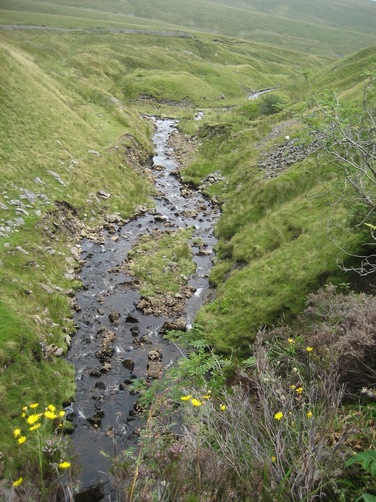
A delightful ford takes us over Little Dale Beck as the barren Blue Clay Ridge dominates the moorland to the east.

Little Dale itself is a delightful little stopping point. The water is passing across the shales and glacial debris of the lower Yoredale Series. When it does meet the Great Scar Limestone two miles or so downstream, it plays a famous vanishing act as Winterscales Beck, later becomes Chapel Beck near Weathercote Cave, and eventually runs down the Ingleton Waterfalls as the River Twiss. This water has a big adventure ahead of it!

A lovely little footbridge has been built across the beck for those who don't like to get their tootsies wet.

Hands up if you think Ingleborough and Penyghent can boast one of these? The Midland Railway Company elaborately channeled the waters of Force Gill over the line by building this wonderfully designed aqueduct, which seems to fit perfectly into the landscape. It even has an ingenious set of miniature waterfalls for good measure.

It's worth a good study, with its wonderfully curving aspect: an admirable feat of engineering.

A glance to the right just beyond and railway buffs will be having a field day. Blea Moor Tunnel, 2.4 km (2629 yards) long, was built between 1870 and 1875 and connects this barren moorland with Dent station. The spoil heaps on the hillside behind can be seen, where men sank shafts over 200 feet deep into the hillside to allow the navvies to access the far reaches, and which have since been used for ventilation, allowing diesel fumes to escape. Whernside has more than its fair share of engineering marvels, and his has got to be the finest of them. Needless to say, working conditions were beyond belief and on one occasion cuttings filled with water and drowned several of the workers. The navvies worked in candlelight with nothing more than picks, shovels and gunpowder: 12 hours a day, 6 days a week. In winter, many never saw daylight for weeks at a time. Those who wished to close this line had much to be ashamed of.

A large slump of glacial till and debris covers the lower reaches of the Yoredale Series and can be clearly seen in this photograph.

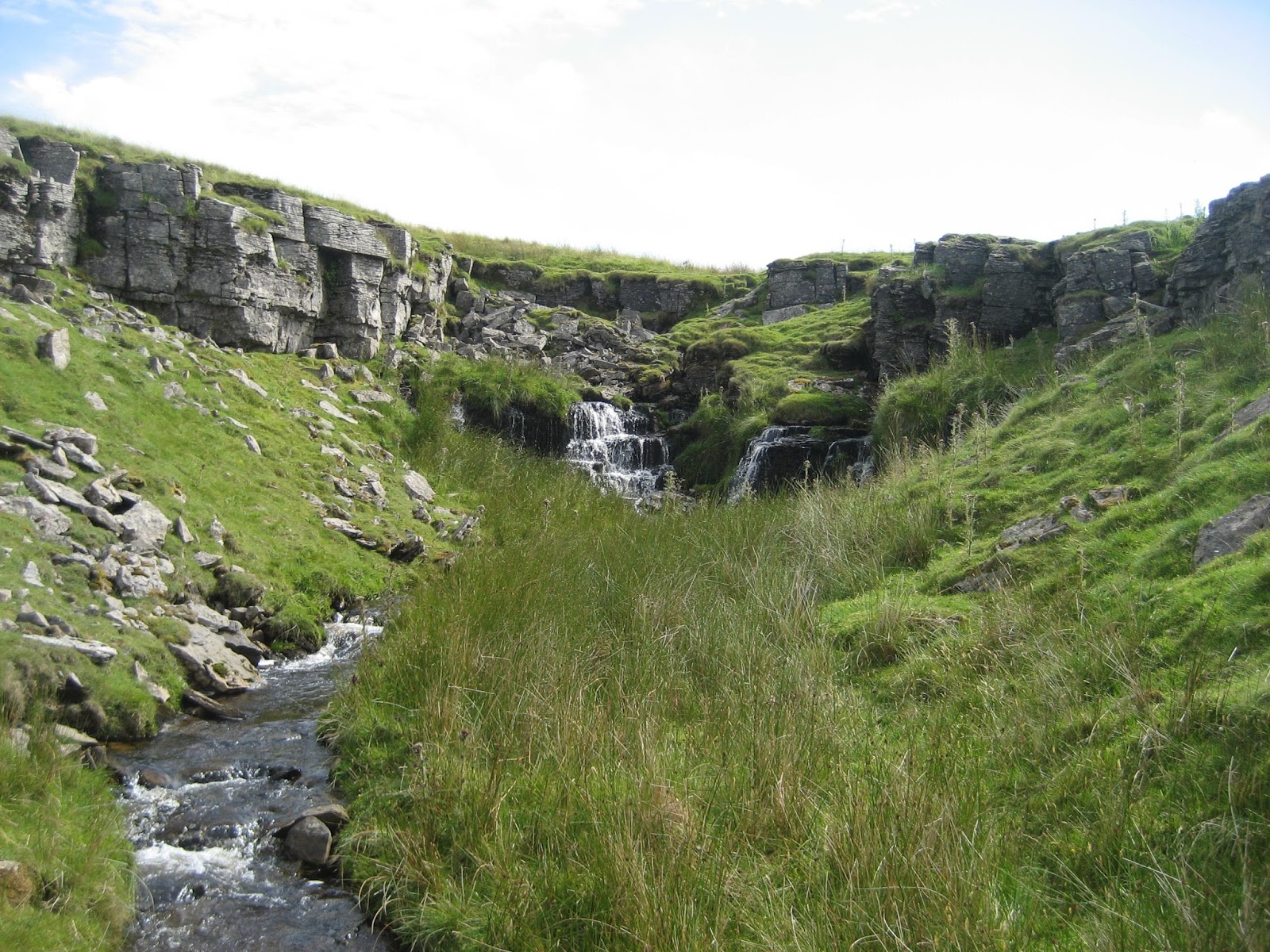
We have crossed the aqueduct into Force Gill itself, and this is where Whernside is at its very best. See those walkers up there? Well, they are following the treadmill to the summit and won't have time to join us. We are going to meander upstream past a superb series of features ... and do you know something? I bet we don't see another human.

Force Gill is completely stunning, especially at the moment when you first see the fall plunging over the ravine, and the way the streams have cut around resistant rock either side to leave a diamond-shaped island.
The approach is beautiful and never fails to impress.

An attractive bed of shale in the side of Force Gill - formed when sea levels fell millions of years ago and muds were washed into what would have been a swampy, very shallow lagoon. These shale beds are a notable feaure of Force Gill, and it is easy to pick out each band as you proceed up the valley.

Force Gill Lower Fall they call it - and how magnificent it is. In fact, I prefer it to Thornton Force for its wild setting and surrounding colour. At certain times of year, rowan berries set it off to perfection. Surely it deserves a better name. I call it Horseshoe Spout, to avoid overuse of 'force' or 'foss' and give it the unique status it deserves. The 'horseshoe' will soon become apparent. The fall has formed where water has plunged over a lip of sandstone in the Yoredale Series and cut back a large bed of underlying shales.

Sandstone above, caused by rivers washing in large quantities of sand and gravel - and shales below, where sea levels were probably even lower and banks of mud built up. Geology is at its very best in Force Gill.
Approaching the Horseshoe Spout.

The sides of the amphitheatre are littered with boulders of sandstone and limestone from the Yoredale Series.

Some of the boulders are very attractive, and contrast well with the vegetation.

Exposed geology at the Force Gill Horseshoe, showing the division between the different beds of rock as well as anywhere in Yorkshire.

The wild view down the gill towards Little Dale, from which much of the stone for the great railway projects was quarried.
A view of the entire Lower Fall at Force Gill, the Horseshoe Spout - showing a prominent landslip and the spectacular nature of this little-known gem.

Sandstone outcrops flank the upper reaches of the amphitheatre surrounding the waterfall.

Ferns, heather, wild rock and floral decoration: Yorkshire at its finest.

Standing at the top of the waterfall is excting indeed. This is the very point at which it makes the plunge.

Ready ... steady ...
Go!

I can never understand why this waterfall is not more celebrated. It's among the finest I've seen. Janet's Foss at Malham, for example, is known by thousands ... but how much more spectacular is this?

Heading up onto the west bank of the beck, there is a fantastic view of the horseshoe profile of the gill at this point, where the stream has cut back more powerfully in the centre than at the sides. It's a perfect 'U'. The fall can be seen entering on the left.
The fall is particularly splendid from this side - a foaming tumble of white water.

Looking up the gill, the successive bands of rock have influencd the development of smaller waterfalls.

From the top of the 'Horseshoe Spout' the stream moves either side of a small, resistant island and the water itself resembles a wine bottle, with long slender neck, as it winds its way down towards Little Dale.
This can be seen perhaps more clearly on this photograph, framed by a natural rock garden.

Just above the next fall we meet the first developed band of limestone in the Yoredale Beds. It can be seen forming the little scars across the stream. Unlike the famous Great Scar Limestone for which the Dales are famous, this varies in colour and is very disjointed. As it was formed in very shallow, muddy seas it is darker on the whole and contains many fossils.

Here is that same band of limestone in close up. Notice how it is mottled by water action, something you don't see on the sandstone beds, which can look very similar. Imagine this was once just a mass of tiny creatures living in a muddy, sea-washed estuary.

Water seeping down the faces of the limestone has already carved a series of runnels into the soluble surface.

Another view of the thin limestone bed in the lower reaches of Force Gill, with the water flowing across a shale bed below it.

Upstream, the beck has cut through joints in the limestone to form this complex of cascades. Notice the more rounded nature of the limestone blocks, compared to the angular sandstone seen downstream. The rusty colour is caused by impurities in the rock.

These cascades are another highlight of Force Gill, and are well worth a visit.

Water appears to be everywhere when you tackle Whernside by this route. It's invigorating!

Cascades tumbling over the steps of the Yoredales are more typical of Wensleydale, and are quite unusual in Three Peaks country.

Looking back down the length of Force Gill, with Penyghent peeping in the background.

Just look at how often those sea levels fluctuated. Here we see a bed of shale below, topped by a thin sandstone sandwich formed when sea levels rose slightly and rivers were able to wash in larger and coarser material. Above is another layer of shale, which is, of course, no more than hardened mud, composed of much finer materials than the more gritty sandstone. Only when sea levels rose sufficiently to allow life to flourish in shallow water were conditions suitable for limestone formation. A small fault appears to be moving down the centre of the lower shale bed, so the rocks on either side don't match up.

This small island in the stream is flanked by steep valley sides on the right and it is tempting to cross the beck. However, the trick is to stay on the right hand side of the gill, so carefully scale the hillside here and traverse the higher reaches until you can once again descend to the stream. Note again here a thin sandstone layer, indicated by the protruding slab, overlying the bed of shale across which the stream is running.

Here it is in close up. There are few places in Yorkshire where geology is so easy to appreciate.

As we once more return to the beck after a traverse on the right, the alternating succession of rock bands has created an impressive series of stepped waterfalls. Ahead, the gill heads to the left of the great banks of glacial debris towards even more stunning scenery.

These falls tumble over more resistant sandstone to the shale beds beneath.

This one is a fine example.

The fall, seen on the left, tumbles over the resistant sandstone and limestone layers to the shales lining the river bed.

The walls close in and lone walkers may feel a sense of trepidation until the beautiful upper waterfall of the Mare's Tail is reached. This is one of the great features of the Yorkshire Dales when there is plenty of water coming down, and standing at the top is a literally breathtaking experience.

A range of fossils embedded in a huge sandstone block just beneath the Mare's Tail. Intrerest is everywhere here.

Water leaving the lower reaches of the Mare's Tail has cut through the thin layers of the Yoredale Beds, which can be seen well in this photograph - almost like the layers of a rocky trifle. A faullt has probably guided the stream here.

Shattered blades of thin sandstones create a jagged impression on the landscape, with softer shales below.

The thrilling point at which the waters of Force Gill pop over a layer of resistant rocks and plunge down the 50 foot Mare's Tail, one of the most elegant waterfalls in England. Far fewer people have seen this one than its lower cousin.

The Mare's Tail is usually one thin ribbon of white water, but today there were actually two tails, side by side. I was lucky.

When that rowan tree has berries, the view is even better, but this one isn't bad!
This clip shows the graceful curving sweep of the water, giving the Mare's Tail its name.

This may look a dull panorama, but over there on the moor you can see the ventilation shafts and spoil heaps of the Blea Moor Tunnel, which lies some 200 feet below the surface. Heaven knows how htey worked up there, poor fellows!

Above the Mare's Tail, we meet the undulating landscape of Grain Ings, where a layer of glacial debris begins to dominate the plateau formed by that little niche glacier I mentioned earlier. The trick is to stay with the stream on its left hand course, and not to be diverted by any other incoming tributaries.
At last, we reach the very head of Force Gill, where the water resurges from beneath the Main Limestone, part of the Yoredale Series, and where we have a resurgence, we have, of course, a cave system.

Caves formed on the Yordedale limestones can never have the huge chambers and shafts we see on the Great Scar Limestone, as the beds are only thin. They are also more prone to collapse. Here, at the Greensett Caves, on the plateau above Force Gill, the beck briefly leaves one section of low cave before vanishing into another.

The stream emerging from Greensett Cave flows out from under the limestone onto a shale bed.

Water and ice action on the plateau has left several bizarre features carved from the Main Limestone, such as this little fella - I call him the Greensett Gremlin. He has a wicked grin! Notice the fragile nature of the limestone in this photograph.

Close up of the Greensett Gremlin, remnant of a fragile limestone pavement exposed by the glacier.

Water passing along a shale bed into the limestone once again.

Cavern collapse around the Greensett Caves has left little windows where the water pops out of one hole ... and into another. Note the layer of peat at top right indicating that this area was once clothed in vegetation.

All the dry entrances into the Greensett Cave system are small and uncomfortable to negotiate.

Pavements in the Main Limestone, the thickest layer of the Yoredale limestones, can never compare with the wide expanses of those formed in the Great Scar, around Ingleborough and Malham. The rock is already loosely structured so weathers very easily into widely spaced, rounded clints. Nevertheless, they are welcome splashes of colour on the moorlands of Whernside. The niche glacier previously mentioned scraped away the layers of rock above to leave this little bench exposed.

High water conditions and melting ice have, over time, worn away the outer edges of the pavement to leave an outlying ring of rocks including the Greensett Gremlin. He looks happy about it!

Looking east over the pavements. Let's not forget that Whernside has, arguably, the greatest of all the limestone pavements in Britain, all be it on her extreme south western flanks, on Scales Moor. Does that count as Whernside? She's not going to argue, is she?

Weathering means the fragile limestone is very gradually eroding away altogether.

There is the occasional vertical shaft into the Greensett Cave system. The name 'green sett' could not be more appropriate. There is beauty on Whernside when you seek it.

This is about the most accomodating entrance. The ferns decorating it are a give away, and it's a simple hands and knees crawl in, where it eventually does open out. Take an old pair of trousers - nobody will see you getting changed. A nudist camp here would barely be noticed! (excuse the pun).

There are many other sinks into the cave lying very close to the dry entrance.

The dry entrance to Greensett Cave can be seen in this hole, easily located by its proximity to that large peat hag. Basically, you come up onto the plateau from Force Gill, locate the south west corner of the pavement area ... and you'll soon see it.

Greensett is not the prettiest cave: they rarely are in the Yoredale limestones, but this active vadose passage is superb. Water has worn through the limestone vertically until meeting more resistant rock below, where erosion has been sideways through the limestone, creating a classic 'keyhole' shape.

Inside, it's a mass of boulders - some of them looking too unstable for comfort.

This is a good example. An exit waiting to topple - and best avoided!

What's that? A human? Yes, and an odd one at that, perhaps - making his way to a 'reasonable exit'. He looks happy enough, doesn't he? Self portrait of course, this one.

There are all kinds of flood debris littering the floor of the cave.

Daylight at last, through a lovely mossy exit.

Let's get out, folks. I've had quite enough with no caving gear ...

Bet I'm the first person to come out of that little hole for a long time. I felt almost guilty having squeezed over that carpet of lush vegetation.
Looking back in an easterly direction across the area of the Greensett Caves, with the obvious layer of moorland peat for company.

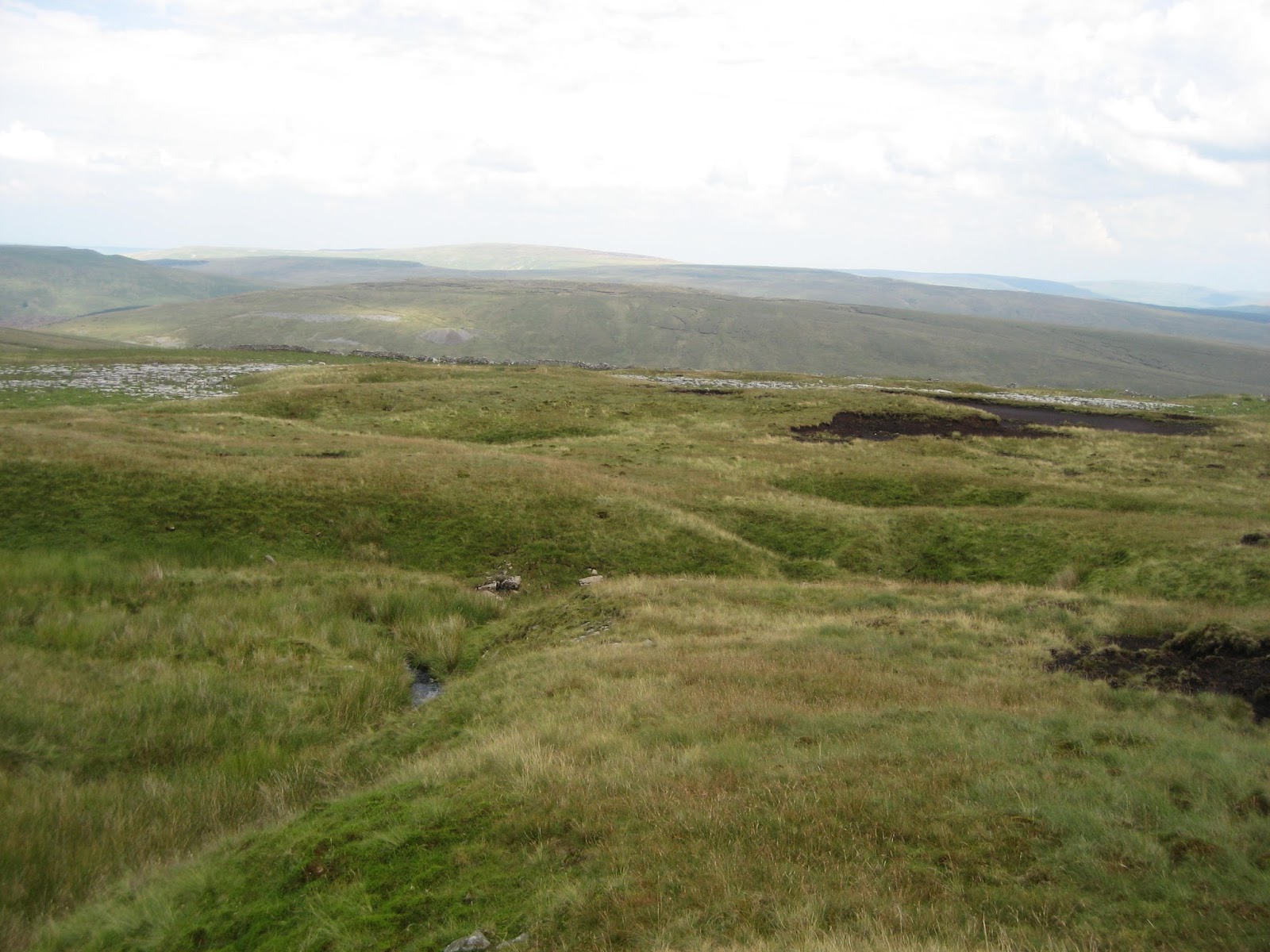
We then head towards the slopes of the mountain, scaling a small barrier of moraine which in fact was dumped by the niche glacier and, in the process, held back the waters of this upland lake, Greensett Tarn. Ingleborough doesn't have one of these either. That's two up to Whernie. She's getting proud of herself! Don't get carried away, lass ...

The dark waters of the tarn will usually be yours to keep. It is the home for many species of dragonfly and contains rare upland water beetles. It rests on an impermeable layer of glacial debris.

The acid conditions are influenced by the layer of peat which plunges into the water from the lower slopes of the Whernside summit mass.
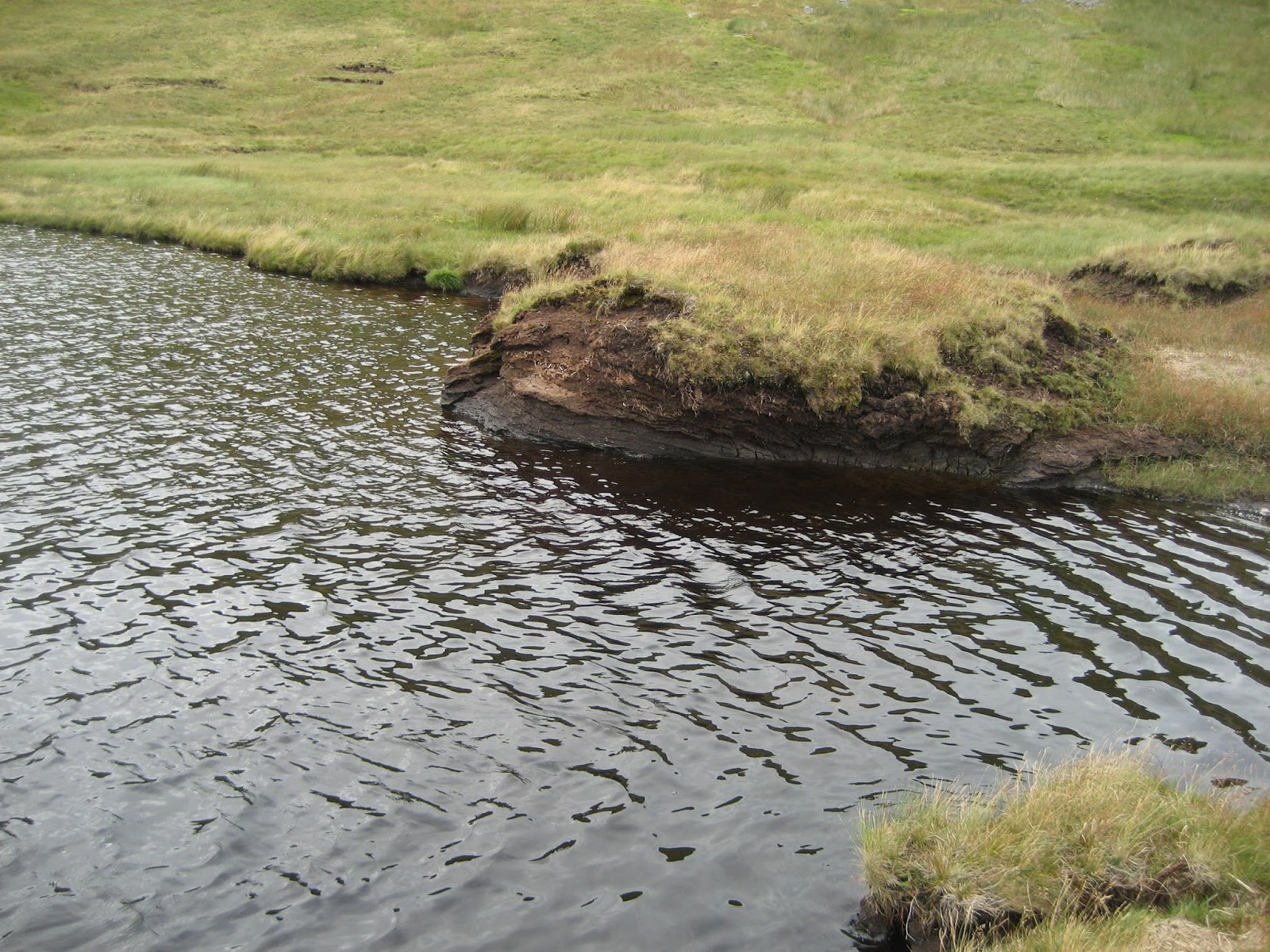
Dark murky waters, stained by peat. On winter days this can indeed be a bleak place.
 |
As we start to scale the last slope onto the summit, however, Greensett Tarn manages to take on a beauty of its own, appearing as an undualting silver island in a green ocean. Lovely.
|

Promising! The ridge is reached and is begining to drop away. Just look at all that erosion !

Looking north from the summit ridge to the exposed and very secluded Whernside Tarns.

The beautiful, emerald green upper slopes of Whernside have to be seen from this angle to be fully appreciated. Look at dull old Ingleborough in the background (only kidding on that one!).

Looking north west into the green valley of Dentdale, with the Howgill Fells behind.

Suddenly, the tarn is like an oversized puddle. The caves we visited, by the way, are between the tarn and the limestone pavement at top right. The moraine barrier holding back the tarn can be seen clearly.

Life at last, and the usual company as always ...

They're not daft: the best grass has to be climbed for, doesn't it, ladies?

The grassy promenade at the top of the highest of the Three Peaks is totally brilliant. The views are magnificent in all directions, even if it was a little hazy today.

Yaaaaay! Concrete Ordnance Survey Columns. I love them .... (well - perhaps not but .. you're there aren't you?)

Before you ask, a sheep didn't take the picture. By sheer luck there just happened to be another guy there - and he was a nice chap.

Sad this life of ours at times, isn't it? You have a great conversation with someone you've never seen, in a wild place, and then they disappear forever. If you read this, Mr X from Kinross, get in touch ... (you took a good pic, by the way).

Ingleborough surrounded by its plinth of Great Scar Limestone across Chapel-le-Dale.

And again ... no wonder they once thought she was the highest mountain in Britain.

The one thing I detest about Whernie is that horrible path from Bruntscar which is best left to the descent - if it has to be used at all. My toes were nearly dropping off!!!! How would I ever manage on the Three Peaks walk???

Descending towards the green pastures in the upper reaches of Chapel-le-Dale.

Rustic views, extending to the starting point at Ribblehead.

Broadrake - an attractive farmstead on the easy walk along the pastures beneath Whernside.

'Hey - it's him again ...'

Approaching Ivescar - famous for its caves behind, the Boggart Holes (see my post from May - Wandering Under Whernside)

A lovely view of Ivescar with Whernside trying to look shapely behind.

Barn on land - barn in water. Lovely spot, this, on the way back to Ribblehead.
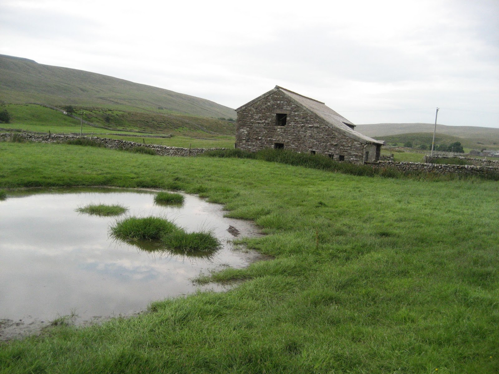
That grassy face in the pool ..... is pretty cool.

Just about to complete the circular adventure by meeting the viaduct again.

And over there is my little silver brum brum - the last one left on the car park ..... as per usual. Hope you enjoyed this tour around Whernie, and that you have now warmed to her many delights.

My route from Ribblehead. I walked alongside the line to the aqueduct and then diverted into Force Gill. I'd be keen to hear from people who have enjoyed the waterfalls in the gill, and I hope more people grow to admire this really fine mountain, rather than simply ticking it off. There wasn't a boring moment on this adventure.
Stephen x
I've always rather liked Whernside. And, if I remember correctly, it was the first of the 3 peaks I actually climbed. And I've also done it from Dentdale/Deepdale, which I reckon is my preferred option, and in winter, too, which is awesome!
ReplyDeleteThanks Jules - the view is arguably better than Ingleborough's and now you've reminded me I must do it from Dentdale later in the year perhaps in winter like you suggest. Views were a bit hazy on this session - hopefully get that full view along Dentdale to the Howgills in the winter time. Cheers and hope you enjoy the blog!
DeleteStephen :)
Superb!!
DeleteI enjoyed reading this, particularly the geology lessons. I'll be visiting again. :-)
ReplyDeleteMany thanks for the comments. Get up into Force Gill with a flask of coffee and its total escapism!
ReplyDeleteI went up Whernside earlier this year by Force gill when it was full of ice, what a wonderful way up to Whernside it was and i loved every minute of it. I have some photos on Facebook if you care to look at them :)https://www.facebook.com/alan.oconnor.311/media_set?set=a.10151538318806117.1073741829.725356116&type=3
ReplyDeleteCheers Alan: I will have a good look. Pity so many miss out on it as it's an easy climb up as well with quite a gentle gradient. I must get up there in the ice - not that I'm wishing the winter upon us!
ReplyDeleteGood to hear from you
Stephen :)
We enjoyed our climb up Wernside and the views are exceptional. Thanks for sharing such a detailed account of your trip. I especially love the bits of geology and history you add to your posts.
ReplyDeleteHi Stephen , hope your well !
ReplyDeleteAny plans for a second edition to
A Three peaks up and under ?
Think I've read it three times lol and another book would be great 👍
All the best Jez